Ever since I started fishing avidly in April, people have been giving me advice about which Mississippi River pool to fish for various species. If you want Bowfin, try this pool. If you want Sturgeon, try that pool. Looking for Walleye? Fish another pool.
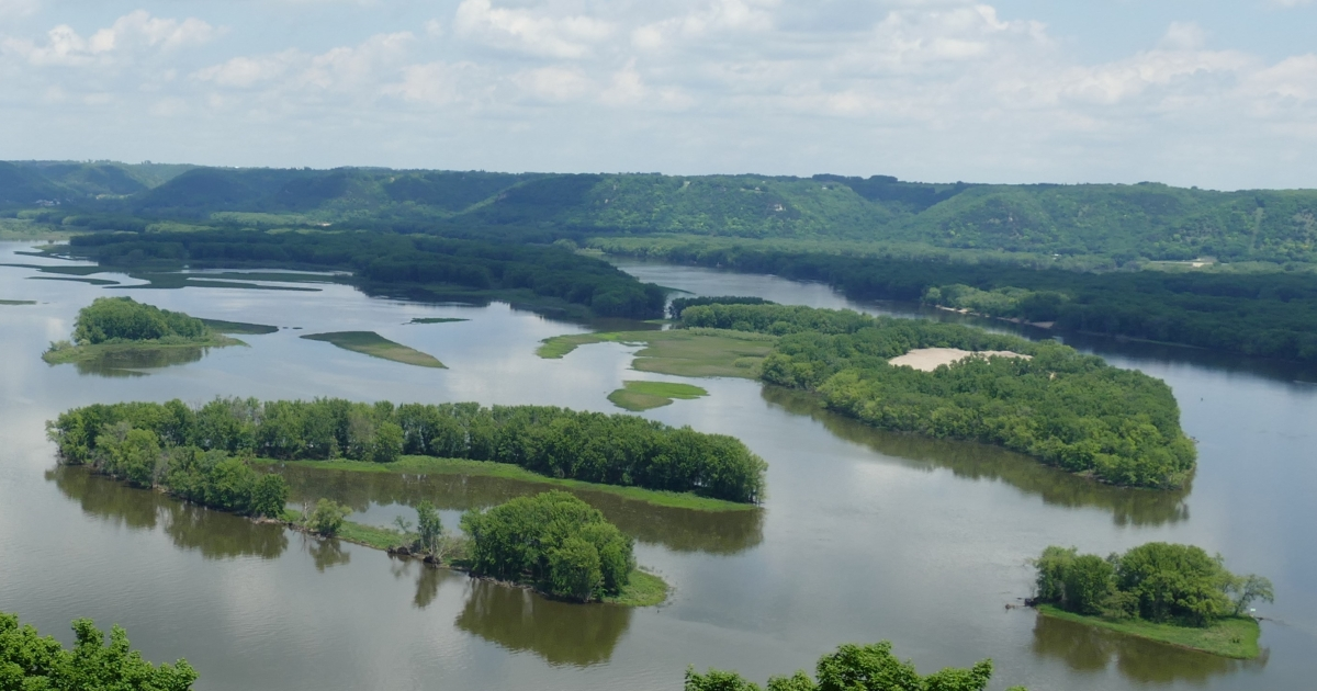
I was vaguely familiar with Mississippi River pools but became curious about exactly what they were. I knew they were stretches of water associated with locks and dams on the Mississippi River, but surely they had not always been there. How many pools are there? Where are they located? And when were they built?
The Mississippi River pools begin in Minnesota, where the Mississippi River originates at Lake Itasca State Park. The pools are numbered consecutively as you travel downstream. The first Mississippi River navigation pool is Pool 1, located in the Minneapolis-St. Paul area. It extends from Lock and Dam 1 (the Ford Dam) upstream to St. Anthony Falls in Minneapolis.
A pool is the stretch of river between two locks and dams. Each lock and dam creates a backed-up section of river known as a pool. The pools are numbered in sequence as you move downstream. Pool 1 is in Minneapolis, Pool 2 is near St. Paul, Pool 3 is near Hastings, and Pool 4 includes Lake Pepin, one of the most popular fishing destinations in the Upper Midwest.

The last numbered Mississippi River navigation pool is Pool 26, located just north of St. Louis. South of Pool 26, the river becomes open river and flows freely all the way to the Gulf of Mexico without additional navigation pools.
Back in Mark Twain’s day, there were no Mississippi River pools. The Upper Mississippi was a free-flowing river with islands, side channels, wetlands, sandbars, and highly variable water levels. Commercial navigation was often difficult and sometimes impossible during periods of low water.
The locks and dams that created the pools were built primarily to provide a reliable 9-foot-deep navigation channel for commercial barge traffic between Minneapolis and St. Louis. The dams create deeper pools of water, while the locks act like elevators that raise and lower boats between pools of different elevations.
Most of the locks and dams that created Pools 1 through 26 were built during the 1930s, with the majority completed by 1940. A few notable exceptions include Lock and Dam 19 at Keokuk, Iowa (completed in 1913), Lock and Dam 1 in Minneapolis (1917), and Lock and Dam 2 (1930). The project transformed the river into what the U.S. Army Corps of Engineers has called a “stairway of water,” with locks functioning as elevators that move boats and barges from one pool to the next.
The locks and dams have had both positive and negative effects on the river ecosystem.
Negative impacts include the loss of a free-flowing river, increased sedimentation in backwaters, altered fish habitats, changes to islands and side channels, and the spread of invasive species. The navigation system created a more connected waterway, making it easier for some invasive aquatic species to move throughout the river system.
On the Positive side, the locks and dams created a reliable commercial transportation corridor, which was their primary purpose. They reduced transportation costs and helped farmers and industries throughout the Midwest reach national and international markets. Construction of the system also provided thousands of jobs during the Great Depression.
The pools created recreational opportunities since stable water levels support boating, fishing, waterfowl hunting, birdwatching, and other outdoor activities. Although some natural river habitat was lost, the pools also created extensive backwaters, marshes, side channels, and aquatic vegetation beds that support many species of fish, migratory waterfowl, bald eagles, and other wildlife.
In addition, many river communities upgraded their sewage-treatment and drinking-water systems after the pools were created because water-quality problems became more apparent in slower-moving water.
Finally, while the lock-and-dam system was not designed for flood control, it does provide more predictable river conditions for navigation and recreation than existed before the dams were built.
Overall, the locks and dams transformed the Upper Mississippi from a shallow, often difficult-to-navigate river into a dependable transportation corridor while also creating many of the fisheries, backwaters, and recreational opportunities that anglers enjoy today. The trade-off was the loss of much of the river’s natural, free-flowing character. Many of the productive fishing areas that exist today are a direct result of the pool system, while many of the river’s original sandbars, islands, and natural channels have been altered or lost.
 OneHundredFish